 plan
planCross Island Line and Serangoon North plans will divide District 19’s landed winners from its disrupted streets
Hougang, Serangoon and Sengkang are gaining transport links, housing and green connections, but their effect on landed values will turn on walking routes, construction exposure and what changes beside each plot.
The gist
- Hougang, Serangoon and Sengkang are gaining transport links, housing and green connections, but their effect on landed values will turn on walking routes, construction exposure and what changes beside each plot.
- District 19’s planning story is becoming tangible.
- None of this supports a blanket claim that landed homes across Hougang, Serangoon and Sengkang will rise together.
District 19’s planning story is becoming tangible. Cross Island Line stations at Hougang and Serangoon North are under development, a residential Government Land Sales parcel is planned at Serangoon North View, and longer-term changes around Defu and Paya Lebar Air Base could reshape the district’s eastern edge.
None of this supports a blanket claim that landed homes across Hougang, Serangoon and Sengkang will rise together. The more credible effect is greater price differentiation between streets: practical access to transport, parks and amenities may strengthen one address, while construction, traffic or higher-density development may complicate another nearby.
The gist
- Cross Island Line Phase 1 includes Hougang and Serangoon North stations and is scheduled to open from 2030.
- The proposed Serangoon North View residential site covers 0.80ha and carries a maximum gross plot ratio of 2.5.
- New and improved recreational links through Hougang, Serangoon and Sengkang could enhance daily convenience, but their usefulness depends on actual access from each landed enclave.
- Paya Lebar Air Base’s relocation and phased redevelopment represent a major long-term change, not a near-term price guarantee.
“The Master Plan can strengthen the case for a particular street, but it cannot confer the same advantage on every District 19 house.”
Cross Island Line access is the clearest committed change
The Cross Island Line is the most consequential committed transport project for District 19. Its first phase includes stations at Hougang and Serangoon North, creating new cross-island connections and an interchange with the North East Line at Hougang.
For landed households, that matters even when the occupants own cars. Teenagers, domestic helpers, older parents and working adults may rely on public transport at different times, while access to another rail corridor makes a home workable for a wider range of buyers.
The benefit will nevertheless be highly local. A future station does not make every house in the postal district “near MRT”. Walking distance, sheltered routes, major-road crossings and the position of enclave entrances will determine whether residents receive a practical daily advantage.
This distinction is especially important around Serangoon Gardens and Serangoon North. A house may look close to a future station on a map but require a circuitous walk because of road geometry, private-estate layouts or limited crossing points. Another home slightly farther away in straight-line terms may offer the better route.
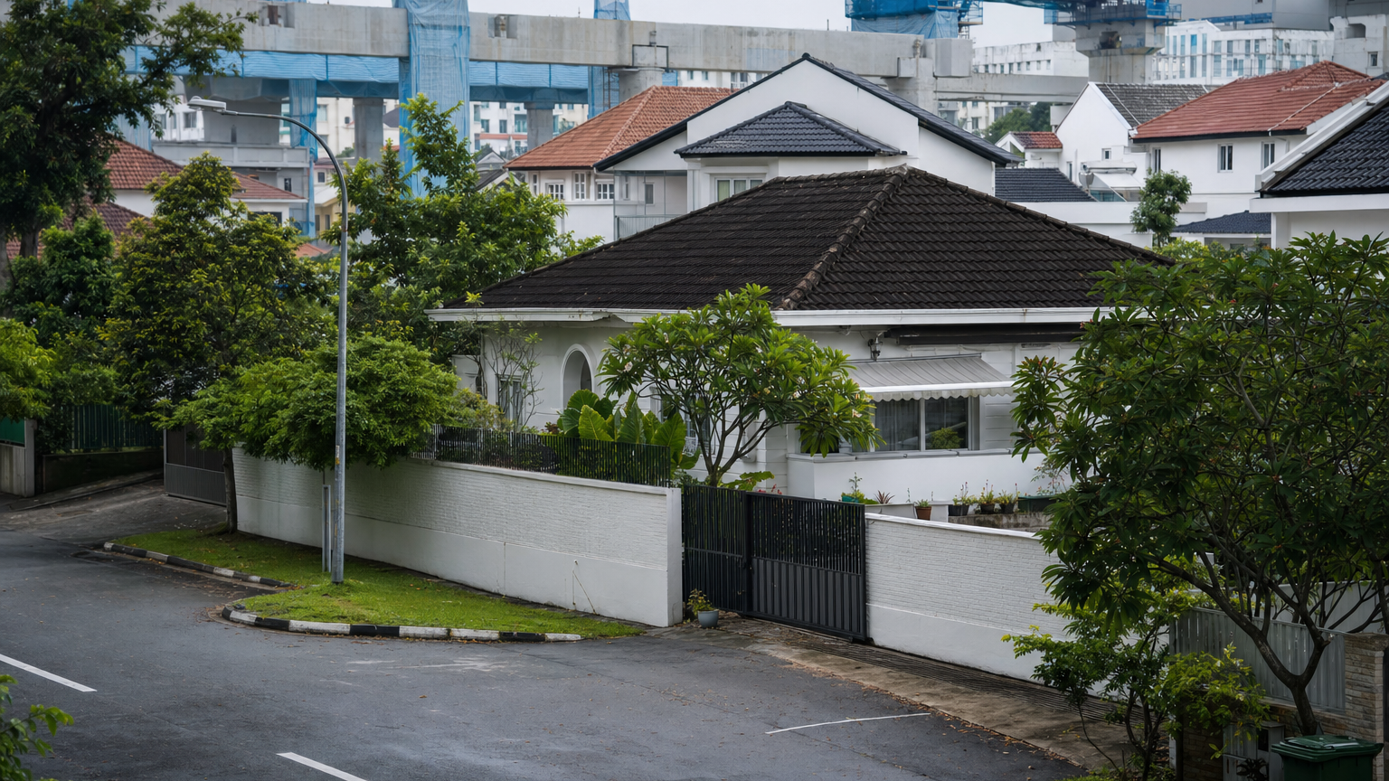
There is also a timing mismatch. The first phase is due to open from 2030, while construction and traffic changes occur before residents receive the completed transport benefit. Near Hougang Central, rail works have affected roads and access arrangements, illustrating how future connectivity can impose present inconvenience.
Owners should not hide that trade-off. A buyer may accept several years of disruption when the eventual benefit is useful and the purchase horizon is long, but another may place a heavy discount on noise, dust or difficult access.
The strongest counterargument is that landed buyers are relatively insensitive to rail because many drive. That is partly true, particularly for large multigenerational households with several cars. Yet MRT access still affects household flexibility and future resale demand, so it is better understood as an additional reason to choose one house—not a substitute for land attributes, road quality or internal condition.
Serangoon North View raises an address-level question
The proposed residential Government Land Sales site at Serangoon North View makes neighbourhood intensification more concrete. The parcel measures 0.80ha, has a maximum gross plot ratio of 2.5, and is identified for residential development.
This does not establish the final number or mix of homes, architectural form, selling prices or completion date. Those details depend on the sale process, approvals and eventual development proposal.
What it does establish is that owners near the parcel should assess more than the future Serangoon North station. A new private residential development could bring a larger resident population, more transport use and stronger demand for nearby services. It could also mean a prolonged construction period, additional vehicle movements and changed outlooks for particular houses.
For a landed seller, proximity may support a convenience narrative if the property sits within an easy walk but remains buffered from the development’s access points. For a buyer, the same project may be less attractive if the house fronts a likely construction route or loses an open outlook.
The site’s 2.5 plot ratio indicates permitted development intensity; it is not evidence that surrounding landed plots have been rezoned or that condominium benchmarks should be applied directly to them. Landed and non-landed homes are priced through different combinations of land scarcity, tenure, redevelopment potential, condition and buyer preferences.
A new condominium can improve recognition of an area without repricing every neighbouring house. Its clearest immediate value is as a prompt to examine entrances, buffers, road capacity and sightlines at the individual-property level.
Green links matter when residents can use them
The north-east plans include a broader network of walking, cycling and recreational routes. The 36km Central Urban Loop runs through Hougang and Serangoon and connects with destinations including Punggol Park, Bishan-Ang Mo Kio Park and the Kallang River. Plans also describe a pedestrian and cycling bridge across the PIE, while the North-Eastern Riverine Loop links parks through Buangkok, Sengkang and Punggol.
These improvements can influence landed demand through everyday usability rather than spectacle. A safe route to a park, school or neighbourhood centre can reduce dependence on short car trips and make an estate more attractive to families.
But buyers should not infer a generic “green premium”. A route shown in a regional plan may still be inconvenient from a particular house because of estate entrances, drains, road crossings or distance. Conversely, a property that is not directly beside a park can enjoy useful access without the foot traffic and loss of privacy that sometimes accompany immediate frontage.
The distinction is between access and exposure. Access means residents can reach a useful route comfortably. Exposure means the property absorbs activity, lighting or noise associated with that route. The best balance will vary by household, and neither effect can be priced reliably from a district map alone.
Sellers with a genuine advantage should demonstrate the real walking or cycling route rather than quote the total length of the network. A five-minute connection from the gate is relevant; a regional loop that residents cannot conveniently enter is mostly marketing language.
Sengkang West could gain amenities—and activity
Plans for Sengkang West include a proposed park within the industrial estate, intended to provide recreation and greenery for residents and workers while improving ecological connections. Separately, Sengkang Town Centre has been identified as a possible location for a more integrated community hub incorporating uses such as healthcare, sports, recreation and commerce.
The wording and status of each proposal matter. A broad planning intention should not be presented as a completed amenity or assigned a fixed opening date without a confirmed delivery programme.
For landed pockets within the Sengkang and Buangkok orbit, these plans could improve access to services and recreation. That could make relatively peripheral homes easier to justify for owner-occupiers who want landed space without being isolated from town facilities.
More amenities also mean more activity. Roads used for drop-offs, deliveries or access to a new hub may become busier, and construction can affect nearby residents before any benefit arrives. A house that can reach a new amenity without sitting on its service route may therefore enjoy a better balance than one that is technically closer.
This mechanism is easy to overlook because master-plan marketing tends to emphasise what a neighbourhood gains. Landed buyers must also ask how people and vehicles will reach that gain.
Defu and Paya Lebar Air Base belong to a longer horizon
The relocation of Paya Lebar Air Base from the 2030s could eventually unlock a major area for phased redevelopment. Current planning material envisages redevelopment beginning around Defu, with new homes, workplaces, transport connections and community infrastructure forming part of the longer-term concept.
This is potentially important for eastern Hougang and locations facing the Defu area. Over time, a former urban edge could become part of a larger mixed neighbourhood, changing access to jobs and services as well as perceptions of how peripheral nearby landed estates feel.
It is also the easiest plan to overcapitalise in today’s asking price. Redevelopment is expected to unfold progressively over a long period, and conceptual plans do not settle the detailed land uses, construction sequence or eventual relationship with individual streets.
There may also be costs during the transition. Major redevelopment can bring years of earthworks, infrastructure construction and altered traffic. More homes and employment uses may improve convenience while reducing the relative quiet that some buyers value.
A seller can reasonably identify PLAB and Defu as strategic context. Treating them as a quantified near-term premium would go beyond the available evidence.
The Master Plan is a starting point, not a valuation model
The statutory Master Plan guides land use and development intensity over a medium-term horizon and is periodically reviewed. It can also be amended through the formal planning process.
That makes it essential evidence, but it does not predict transaction prices. Interest rates, the landed-home supply available at a given moment, rebuilding costs, plot shape, tenure and the condition of individual houses can outweigh a distant planning benefit.
For a specific District 19 property, four layers deserve attention:
- The plot itself: tenure, dimensions, road category, redevelopment feasibility and applicable development controls.
- Immediate surroundings: adjoining zoning, plot ratios, road reserves, access points and proposed amendments.
- Functional access: the real route to stations, parks, schools and shops rather than a marketing radius.
- Transition costs: construction duration, traffic diversions, noise, privacy and changes to views.
This also explains why a Master Plan can affect buyers and sellers differently. A long-horizon owner-occupier may tolerate disruption in exchange for future convenience. A seller competing against renovated houses today may find that an uncompleted station does little to offset poor condition or an awkward plot.
District 19’s planning pipeline is therefore best read as a force for micro-location differentiation, not automatic district appreciation. The developments to watch next are the progress of Cross Island Line works and the eventual sale and design details for Serangoon North View. Those will convert broad planning direction into more specific questions about walking routes, traffic and the outlook from individual landed streets.